Borehole Radar
Borehole radar is an impulse relection method. A transmitting antenna emits short electromagnetic pulses which propagate through the medium surrounding the borehole and are partly reflected on any boundary between materials with different dielectric properties. The reflected signals will be recorded by a receiving antenna and the reflector‘s locations relative to the borehole can be determined from the travel times. This method facilitates the detection of layer boundaries, cavities, karstic structures, weathered zones or anthropogenic structures.
Furthermore crosshole or tomographic measurements between different boreholes can deliver detailed information about the area between these boreholes. Inhomogeneities like natural or anthropogenic voids , air-filled or sediment-filled karstic structures or areas of increased moisture can be estimated in their location and dimensions.
Borehole radar offers a quasi-continuous and thus very fast measurement and can be applied in dry, air-filled but also water-filled boreholes down to a depth of about 1000 m. Thanks to this time and cost efficient method you can gain structural and spatial information about the geology and tectonics of the investigation area as well as about anthropogenic bodies around the boreholes.
-
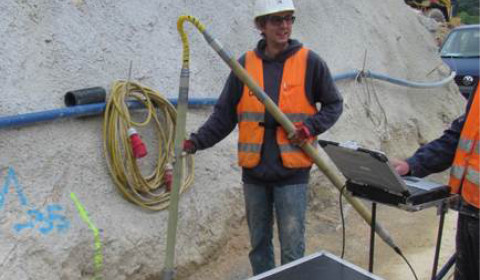
Borehole radar measurements for the detection of karstic structures in tunneling -
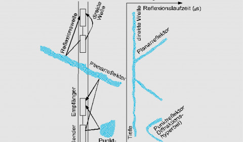
Principle of borehole radar reflection measurement -
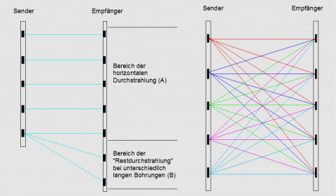
Principle of a crosshole measurement (left) and tomography measurement (right)