Engineering
We support the investigation of your building ground with geophysical measurements and deliver important information for the foundation and planning of buildings. We detect karstified or loose rock areas, artificial or natural cavities or any other kind of inhomogeneity in the building ground or also in existing building material.
Building Ground
-
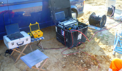
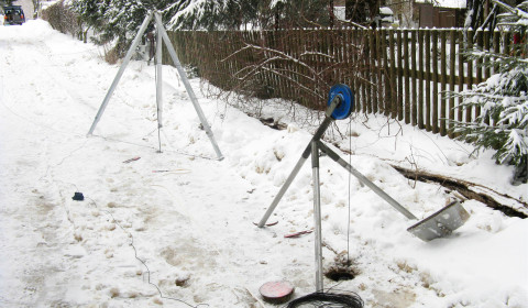
Setup of a borehole seismic survey for the investigation of faults and karst structures
- investigation of the geological-geotechnical situation
- localization of layer boundaries
- localization of inhomogeneities (old buildings, foundations, …)
- localization of natural and anthropogenic cavities
- measurements from the surface or from boreholes
References
- 2013 – 2014: Detailed investigation of the karstification grade around the church of Bad Frankenhausen using borehole seismics
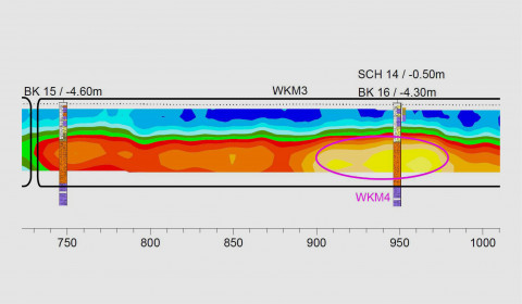
- 2011: Investigation of karstic structures and faults beneath the water reservoir of a pumped storage hydro-power plant using borehole radar and seismic tomography.
- 2010: Investigation of the karstification grade around the planned abutment of a bridge renewal in Rübeland (Harz mountains) using borehole radar
Road and Railway
-
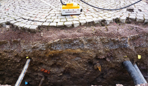
Detection of utilities beneath a street -
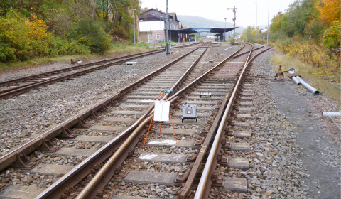
Detection of subrosion zones along a railway line
- investigation of the geological-geotechnical situation
- localization of natural or anthropogenic cavities and inhomogeneities
- measurement fro the surface or from boreholes beside the traffic way
- hence conservation and protection of existing infrastructure (buildings, streets, railways) and no or minimized interference or interruption of ongoing traffic
References
- 2016 – 2017: Investigation of karstic structures along the railway line Wendlingen-Ulm (Stuttgart 21) using borehole radar and gravimetry
- 2015 – 2017: Detection of subrosion zones along a railway line in Sondershausen using gravimetry
- 2010: Investigation of subrosion zones along the planned traffic bypass Könitz using radar
Dykes
-
Comparison of the measured resistivity sections with drill core results -
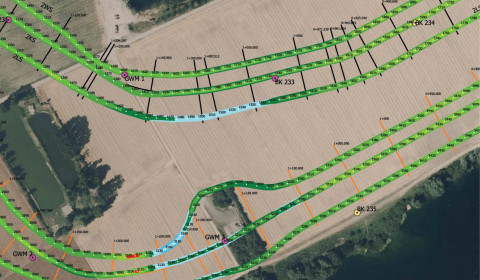
Distribution of the specific resistivities along the planned route of a dyke -
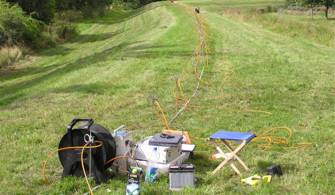
Typical setup of a geoelectric profile along the dyke top
- investigation of the geological-geotechnical situation of existing dykes or planned construction of flood protection structures
- detection of impermeable layers and inhomogeneities for the assessment of the dyke
- localization of structural weaknesses of existing dykes for the stability assessment
- measurement from the surface on and beside the dyke
References
- 2017 – 2018: Investigation of the floodplains for extreme flooding events close to Guntersblum using geoelectric tomography
- 2016 – 2018: Investigation of the dyke and subsurface at Fessenheim using geoelectric tomography
Historic Mining
-
Borehole tomographic measurements for the detection of cavities from historic mining
- detection of areas of loose rock and subrosion due to relicts of historic mining
- detection of natural or anthropogenic cavities (drives, shafts, …)
- measurement from the surface or from boreholes
References
- 2018 – 2019: Investigation of historic mining relicts at the edge of a coal mining area using ground penetrating radar and borehole radar
- 2010 – 2011: Investigation of historic mining relicts beneath the building ground of the new administrativ district office Annaberg/Buchholz using borehole radar
- 2005 – 2007: Investigation of cavities of historic coal mining near Bronkow using borehole radar, ground penetrating radar and geoelectrics
Building Material
-
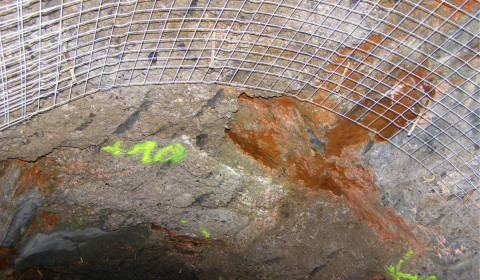
Spalling inside a drainage tunnel -
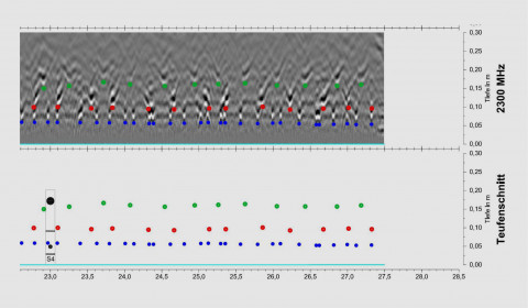
Radargram with high resolution reflectors of steel rebars in a bridge floor -
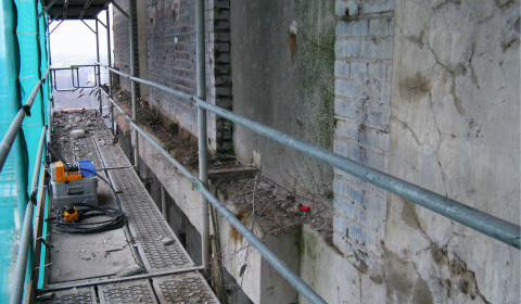
Detection of inhomogeneities in the sustaining walls of a derelict highrise using radar
- non-destructive investigation of the building material of existing buildings
- detection of fractures/fissures, voids, impurities and water pathways
- detection of utilities (cables, pipes, …) and rebars
- verification of consolidation filling of known voids
References
- 2018: Detection of fissures and water pathways in a water reservoir close to Erfurt using ground penetrating radar
- 2016: Localization of steel rebars in bridge in Osnabrück using high frequency ground penetrating radar
- 2014: Detection of wall spalling in a drainage tunnel near Dorfhain using ground penetrating radar
- 2009: Detection of inhomogeneities in the sustaining wall of the U-Turm in Dortmund using ground penetrating radar