Geoelectrics
Electric Resistivity Tomography (ERT) is a commonly used method of geoelectrics that combines both deep and lateral surveying in one electrode setup along profiles to investigate the geological layering or inhomogeneities of the underground. This potential method is suitable for the detection of layer boundaries between sediments or solid rocks as well as locating local zones of different electric properties.
For a survey electrodes are coupled to the ground at a regular spacing along profiles. Using a multi-electrode unit several measurement cycles feed currents into the ground while the resulting voltage in the subsurface is measured via the different electrodes. From these physical parameters and the respective electrode distances the apparent electric resistivity can be determined for certain areas in the underground.
By widening the extent of the electrode setup the penetration depth of the measurement can be increased down to the desired depth level of the investigation. Hence, the optimal measurement setup results from the specific depth and resolution requirements of the survey goal.
The resistivity distribution resulting from complex processing of the data can then provide valuable information about the condition of the underground.
-
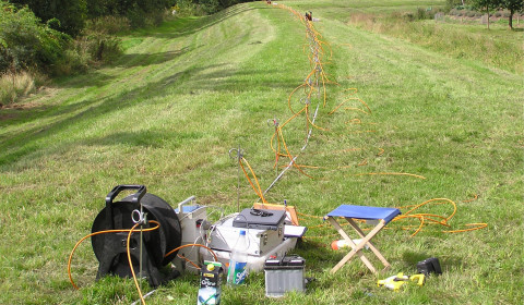
Measurement setup of a geoelectric profile along the top of a dyke for the stability assessment of flood protection structures -
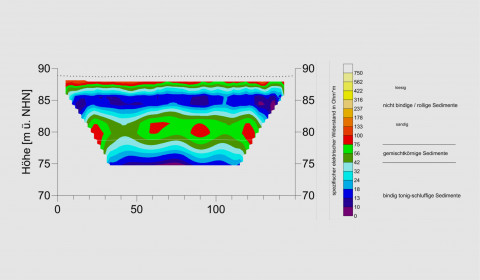
Graphical presnetation of the resulting resistivity distribution of a 2D ERT survey -
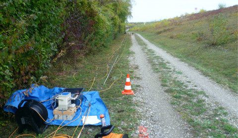
Part of an ERT profile on the landside of a dyke